The recent restoration of the Roman Aqueduct between Collepino and Spello has made available, for nature lovers, a new pathway suitable for trekking and mountain biking. Natural continuation of the Trail 52 (Collepino – Mount Subasio), the path is almost 5 km long, it starts from below the village of Collepino and it reaches the center of the City of Infiorate (the route has the new identification number 352).
The entrance from Spello is the Fonte della Bulgarella (altitude 313 m), instead, on the opposite side, after arriving at the village of Collepino, you have to follow the road lined with benches and wooden tables, it surrounds the outside of the town, then you turn left for a steep downhill road. You walk 1-2 km, until you reach a clearing with a placard indicating the beginning of the Trail of the Roman Aqueduct (altitude 456 m).
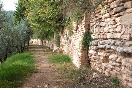
The ancient artifact runs on the slopes of Mount Subasio, along the side of the Chiona river, and the trail follows the entire route of it. Of Roman origin, the aqueduct has fueled the city of Spello until the nineteenth century. Maintenances over the centuries have adapted the building that today it still has some original parts. From Collepino, the conduit is totally underground and then it continues with sections built with local white and pink limestone.
On the downstream wall of the duct they are numerous rectangular openings designed to permit inspection and vents for air circulation. The cover, emerging here and there, consists of plates arranged to “cappuccina” or cambered way. At one point the building serves, today, even as support for the main connecting road between Collepino and Spello.
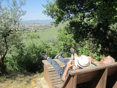
Growing almost flat, the route is suitable for all ages, not presenting significant points of difficulty and it is the occasion for a nice and pleasant walk. The views over the valley of Chiona, the Apennine hills and Spello are breathtaking. The artificial terrace of the Roman Aqueduct sinuously passes through a landscape of great charm. The zone is still intact from the naturalistic point of view, it consists of funds planted with olive trees, dense Mediterranean vegetation and canyons.
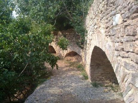
During the journey, the aqueduct also overcomes some bridges, including that of “Parasacco” (high 18 m). At about the midway point, the path and the aqueduct intersect with street Abbeveratoio dell’Asino, where you can draw fresh water from a fountain and you admire the ancient stone drinking trough for animals.
In viewpoints of the route, there are information boards with historic tourist spots, bricks with engraved famous phrases and benches to relax and enjoy the view of the valley.
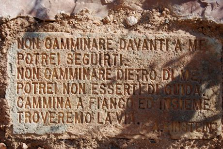
It’s an itinerary that combines in itself culture and landscape, where tourists and passionates can admire the colors and the scents of flora and natural vegetation of central Umbria and breathe a bit of fresh air.

